

Poster Estate Map - Brisbane Suburbs with Subdivisional Surveys, 1889
Library Shop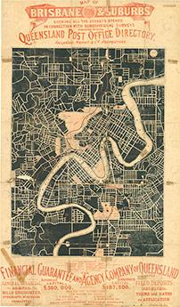
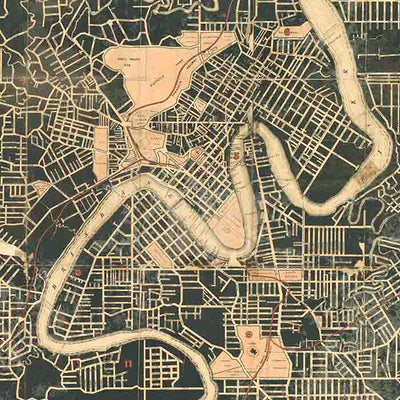
Map of Brisbane & suburbs, 1889, showing all the streets opened in conection with subdivisional surveys. Shows streets (named), railways, reserves, churches, creeks.
Covers area south to St. Lucia, north to Kedron Brook, west to Toowong east to Cooparoo. From the Queensland post office directory.
Print details
34cm x 59cm approx size. Prints are created using archival pigment inks on A2 size 200 gsm archival photo paper with a matte finish.
We leave a small white border of 10-15mm around the image area to protect it during shipping, to avoid fingerprints while being handled, and to allow for framing (prints do not come framed).Prints will be carefully rolled and mailed in a protective tube.
Aside from a small selection in-store, all prints are print on demand. Please allow up to 48 hours for production.
ISBN: PODMA233
Format: Print Art
Dimension: 590mm X 340mm